Chaco Culture National Historical Park and Bisti/De-Na-Zin Wilderness Area
No matter how much I planned and researched for this trip, I was nowhere near ready for where the day took me.
From Albuquerque to Chaco Culture National Historical Park there are two different routes. I chose the southern route via i-40 instead of the northern route. I figured since it was January there’s a high probability of snow in the higher elevations and the southern route would be safer for my Buick. The drive is ~2.5-3 hours, it’s not a quick road trip so I recommend using the toilet and packing snacks because there are no stops between the two locations.
Here is what I did not know before starting my journey…to get to Chaco Culture you need to drive on a dirt road from either direction you take. Read THIS (I obviously did not in detail.)
From the southern route, the dirt road is about 20 miles to the entrance. In the beginning of January, it’s quite a shock upon turning off the main road onto the service road and it’s covered in snow and ice!! Was not expecting that at 7am. My car does not have 4WD, no cell service, and I had no idea the condition of the road beneath the snow, so to say the least, it was an anxiety-induced condition.
After three hours, the Chaco Culture National Historical Park sign appeared and I have never been more grateful or happy for an entrance sign. I think a single tear trickled down my cheek. It might sound dramatic, but as a relatively confident solo female traveler, finding myself in a situation with no backup plan or idea of what to do if things went wrong sent my mind into an overdrive spiral.
Check out Goldie and her offroad coat!


Let’s go exploring!
The main attraction at Chaco Culture is the 9-mile Canyon Loop Drive. Unfortunately, due to snow and my lack of 4WD, I was not able to drive the loop but I was able to hike part of it. Here is the map of the loop - I recommend downloading it before arriving because there is no reception in case the visitor center does not have any brochures.
The hiking trail is a relatively flat and easy one with multiple pit stops along the way. Plan for 3-4 hours of hiking to enjoy the sites. I did not do the entire 9-mile loop since it was covered in snow.
Starting from the Visitor Center I diverted from the Loop and took the one-mile trip to visit the Una Vida & Petroglyphs.
Trail view to Una Vida & Petroglyphs

Una Vida Main House
Una Vida is a Chacoan “great house,” a large pre-planned multi-storied public building with distinctive masonry, formal earthen architecture, and a great kiva. Una Vida exists today in a near-natural state of preservation, free from major vandalism, and with only minor excavations and preservation repairs

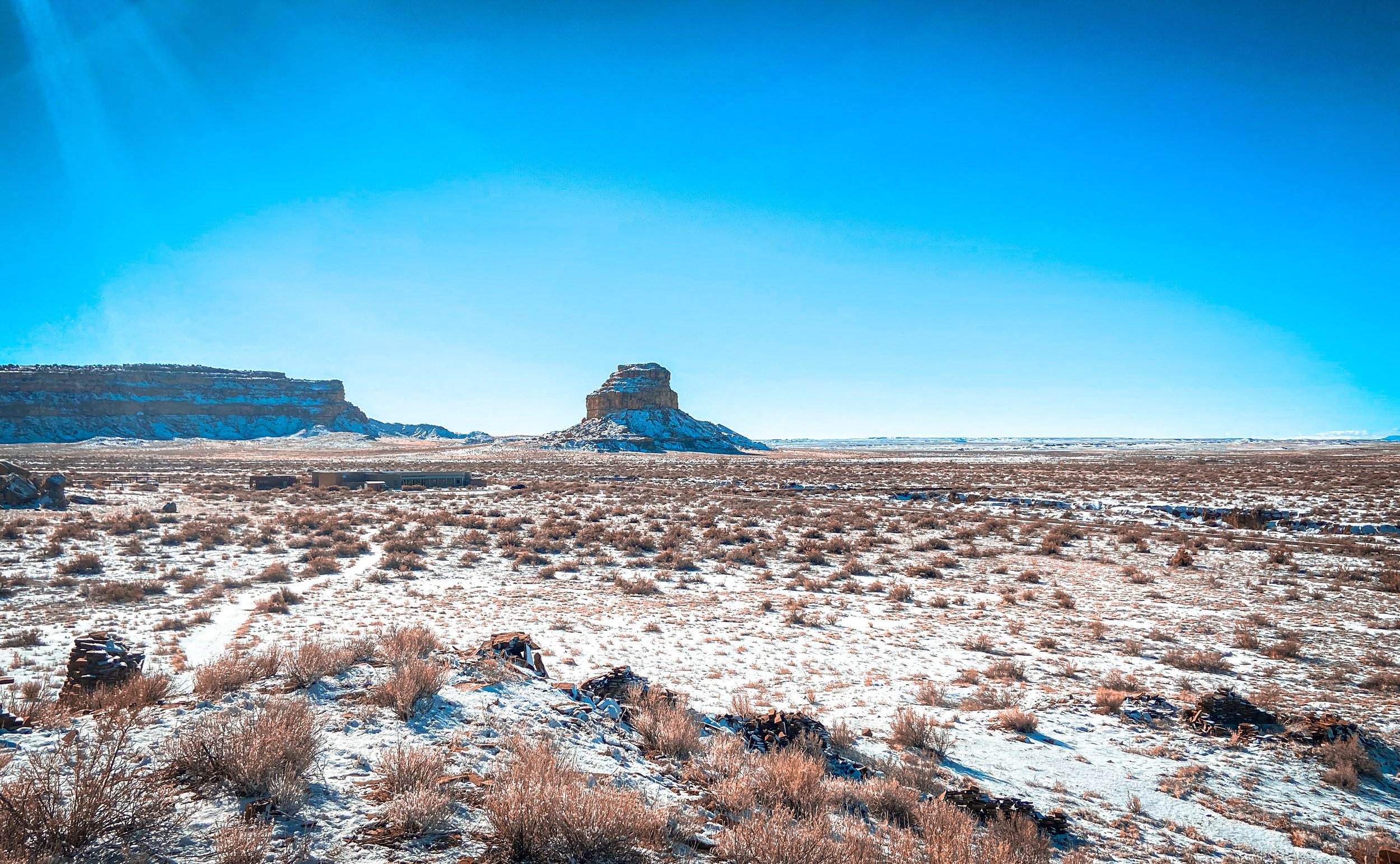
View of the Fajada Butte from Una Vida
Petroglyphs on Una Vida trail

Heading back to the Canyon Loop, about two from Una Vida is the next stop, Hungo Pavi.
Hungo Pavi is an unexcavated Chacoan great house (monumental public building) containing over 150 rooms, a great kiva, and an enclosed plaza. It is a good example of what Chacoan sites look like without excavations--covered with a protective blanket of wind-blown sand and native vegetation.
Hungo Pavi


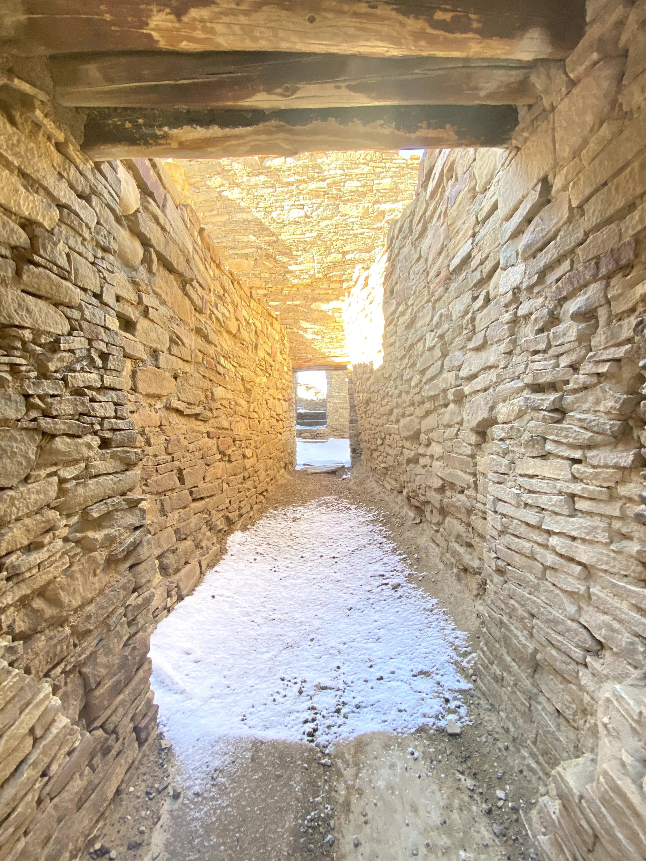
Two more miles down the Canyon Loop is Pueblo Bonito, the most thoroughly investigated and celebrated cultural site in Chaco Canyon. The top-ranked place to see in Chaco Canyon. This is where I spent most of the day and HIGHLY RECOMMEND making your way to the site.
It is the only "great house" within the canyon where you can walk through the rooms featuring Incredible engineering techniques and intentionally detailed masonry.
Pueblo Bonito


Pueblo Bonito Hallway

After exploring Pueblo Bonito, I made my way back to the Visitor Center to gear up for the next leg of my journey. With miles of dirt roads stretching endlessly in every direction, I wasn’t entirely sure how long the drive to my next stop would take. It turned out to be a stressful two-hour journey, crawling along at no more than 10 MPH on bumpy dirt roads with no signs, reception, or any idea of where the highway was. It was a day filled with wrong turns and moments of doubt. A wild ride that tested both my patience and my sense of direction.
Here’s a fun lil video about my journey:
After a very long 2.5 hour drive in the middle of reservation land with no cell service and speeds topping 15 MPH, I’ve never been more happy to see the highway.
Next Stop:
Bisti/De-Na-Zin Wilderness Area

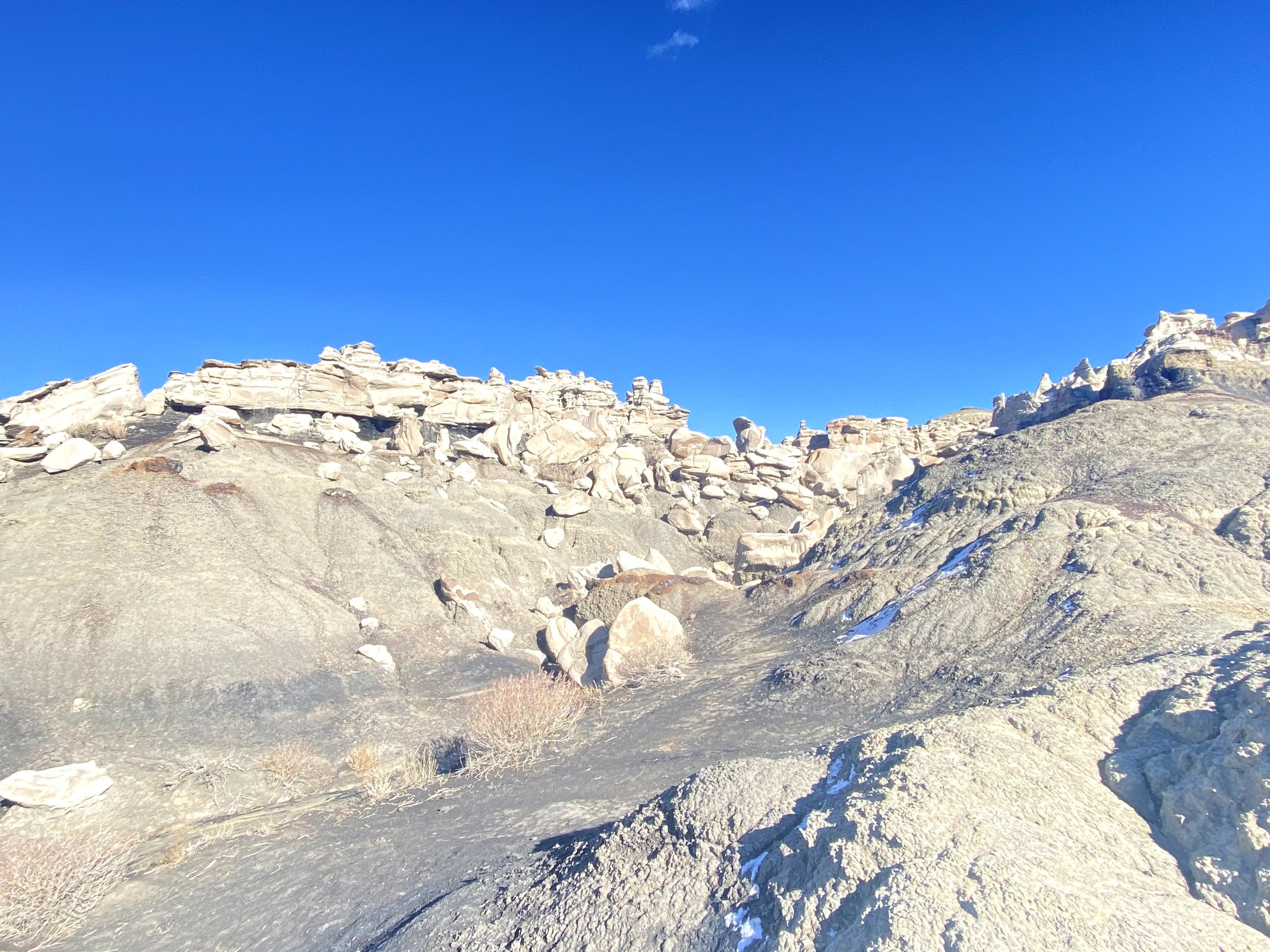
Bisti/De-Na-Zin Wilderness Area, also known as the Bisti Badlands, gives the vibes of a desolate Star Wars planet. With rolling landscape of badlands, Bisti/De-Na-Zin Wilderness Area offers some of the most unusual scenery found in New Mexico. There are a few trails you can TRY to follow along, but they are not well marked. If you have a good sense of direction and know the general sense of direction back to your car, the best way to enjoy the area is to wander and see the great sites.
Bisti/De-Na-Zin is one of those places that has dramatically changed from time and natural elements creating a fantasy world of strange rock formations made of interbedded sandstone, shale, mudstone, coal, and silt. The weathering of the sandstone forms hoodoos - weathered rock in the form of pinnacles, spires, cap rocks, and other unusual forms
I arrived in the late afternoon, and with the early sunset, my visit was short—just a few hours. During my research, I discovered that many travelers spend an entire day here because there’s so much to explore. The constantly changing weather reshapes the natural landscape, making every traveler’s experience truly unique.


After a long day of travel (10+ hours of driving), I collapsed at the Fairfield Inn & Suites Farmington. Stay tuned for the next day of fun.